
Modélisation océanique à haute résolution des fjords de la Colombie britannique
-Par Krysten Rutherford and Laura Bianucci-
L’océan côtier et proche du rivage est une région importante, qui fait office de tampon entre la terre et l’océan ouvert. Par conséquent, elle subit les effets du changement climatique en provenance de la haute mer et absorbe également les effets de la terre et des changements d’utilisation des terres. De plus, elle est souvent la plus utilisée par l’homme pour des activités récréatives, économiques et traditionnelles, ce qui peut ensuite avoir des effets, par exemple des marées noires et des opérations d’aquaculture. Les scientifiques du monde entier ont donc entrepris de mieux comprendre ces régions. L’un des outils à leur disposition est la modélisation océanique à haute résolution.
Laura Bianucci, Ph. D., qui travaille actuellement pour Pêches et Océans Canada à l’Institut des sciences de la mer (Sidney, C.-B.), est l’une de ces chercheuses qui étudient les zones côtières de la Colombie-Britannique. Elle a toujours cherché à mieux comprendre les processus océaniques côtiers, de l’échelle du plateau continental à celle du littoral, et travaille avec des modèles numériques océaniques connexes depuis ses études supérieures. Au départ, son travail était axé sur les modèles régionaux à haute résolution, mais il a évolué au fil des ans pour se concentrer de plus en plus sur les questions relatives aux processus littoraux. Elle est d’avis que le type de modèles à haute résolution qu’elle utilise nous aide à mieux comprendre les parties de l’océan côtier qui sont si importantes pour nous en tant que société et pour l’écosystème.
Comme le souligne Mme Bianucci, les modèles à haute résolution ne sont pas nécessairement nouveaux, mais la puissance accrue des ordinateurs a permis d’augmenter considérablement la capacité de ces modèles au cours des dernières années. Le terme « haute résolution » peut avoir plusieurs significations lorsqu’il s’agit de modèles numériques d’océan, car il existe de nombreux types d’applications pour cet outil scientifique. La résolution d’une photographie (ou d’un modèle) dépend de la taille des pixels (ou de la taille des cellules de la grille du modèle), une photographie (ou un modèle) à haute résolution ayant des pixels (cellules de la grille) plus petits pour capturer plus de détails. Trouver la résolution spatiale optimale d’un modèle dépend en grande partie de l’équilibre entre son coût de calcul et les questions scientifiques posées et les processus modélisés. Les grands domaines de modélisation et/ou les modèles à haute résolution nécessitent davantage de puissance informatique et de stockage; en d’autres termes, ils sont plus coûteux sur le plan informatique. Néanmoins, les processus ou les régions ne peuvent être résolus avec précision s’ils se situent à des échelles inférieures à la largeur de la cellule de la grille du modèle (c’est-à-dire la résolution), ce qui doit être pris en compte lors de l’élaboration de modèles pour des applications spécifiques.
Cet article a été rédigé par Krysten Rutherford, Ph. D., sur la base d’un entretien avec Laura Bianucci, Ph. D., et d’images de Glenn Cooper.
-By Krysten Rutherford and Laura Bianucci-
The nearshore and coastal ocean is an important region, acting as a buffer between the land and the open ocean. As a result, it experiences climate change impacts from the open ocean and also absorbs impacts from the land and land-use changes. Moreover, it is often the most utilized by humans for recreational, economic, and traditional activities, which can subsequently lead to impacts from, for example, oil spills and aquaculture operations. Scientists across the globe have therefore set out to better understand these regions. One tool at their disposal is high-resolution ocean modelling.
Dr. Laura Bianucci, who currently works for Fisheries and Oceans Canada at the Institute of Ocean Science (Sidney, BC), is one such researcher studying the coastal areas of British Columbia. She has always been interested in understanding coastal ocean processes ranging from continental shelf to nearshore scales, and has been working with related numerical ocean models since graduate school. Initially, her work focused on high-resolution regional models, but it has evolved over the years to focus more and more on questions regarding nearshore processes. She believes that the type of high-resolution models she employs help us to better understand parts of the coastal ocean that are so important to us as a society and for the ecosystem.
As Dr. Bianucci points out, high-resolution models are not necessarily new, but increasing computer power has meant that the ability of these models has significantly increased in recent years. The term “high-resolution” can mean many things when it comes to numerical ocean models since there are many different types of applications for this scientific tool. Here, we are referring to a model’s spatial resolution, which is similar to pixels in a photograph – the resolution of a photograph (or model) depends on the size of the pixels (or size of the model grid cells), with a higher resolution photograph (model) having smaller pixels (grid cells) to capture more detail. Finding a model’s optimal spatial resolution depends largely on balancing its computational expense with the scientific questions being asked and processes being modelled. Large model domains and/or high-resolution models require more computer power and more storage; in other words they are more computationally expensive. However, processes or regions cannot be accurately resolved if they are on scales smaller than the model grid cell width (i.e. resolution), which must be taken into consideration when developing models for specific applications.
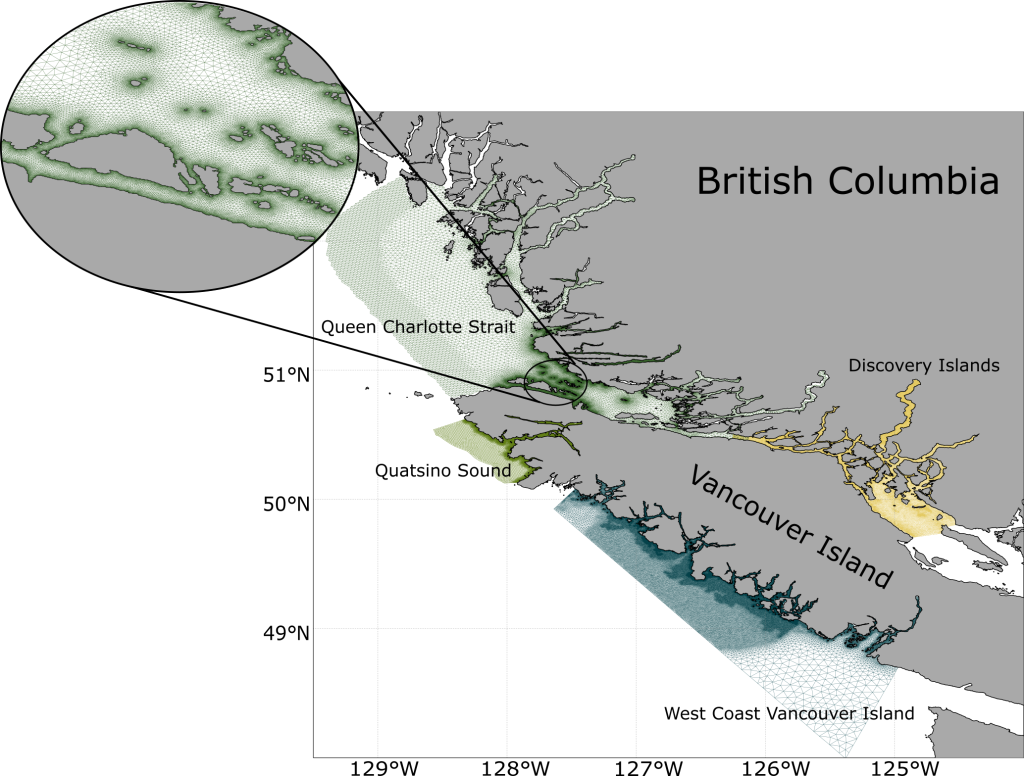
For Dr. Bianucci, who studies the intricate nature of the many inlets and fjords of British Columbia’s coastline, high-resolution often means a model grid cell width ranging in size from 10 to 100 m. These coastal areas are made up of narrow channels that often cannot be resolved with models that have a resolution of >1km. For reference, some high-resolution regional ocean models have a resolution of 2-10km and global Earth System Models (ESMs) often have a resolution of ~100 km. With her models having such high spatial resolution, they often need to cover a smaller area to limit the computational expense. As such, Dr. Bianucci develops model applications for specific inlet and fjord systems. Currently, she is working on 4 different high-resolution models which encompass Queen Charlotte Strait, Discovery Islands, West Coast of Vancouver Island, and Quatsino Sound (see Figure 2).
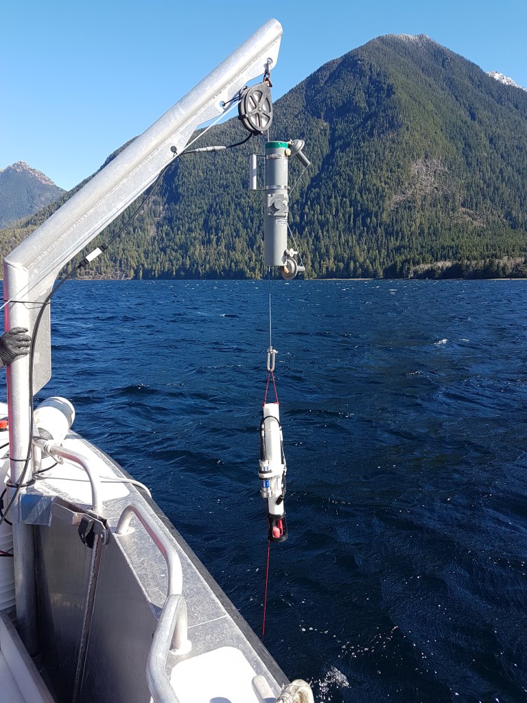
The questions that Dr. Bianucci tries to tackle with her projects are multidisciplinary in nature. As such, she often brings together a diverse team of individuals. “Ocean science today is in deep need of interdisciplinary research and, most importantly, interdisciplinary teams. Siloed research is not the right approach when facing a multifaceted challenge like climate change,” Dr. Bianucci comments. Given that the regions Dr. Bianucci studies are highly utilized by humans, she additionally tries to involve as many stakeholders as possible in her projects. She works closely with fisheries managers as well as with First Nation partners who are interested in finding out more about the resilience of their systems that are changing very rapidly due to climate change. She keeps them up to date on the modelling side, but also integrates them into the implementation of monitoring plans of the various fjords she is studying. Many of these fjords are lacking in observations because it is difficult to visit them frequently and sample in high enough spatial resolution to constrain the system. The implementation of these monitoring plans, particularly when combined with high-resolution modelling, is therefore crucial to better understanding these systems.
Models in general are great tools that can be used to investigate the inner workings of the ocean without altering the real ocean, both at present-day and under future conditions, Dr. Bianucci argues. They are powerful tools that help us interpret sparse observations, and allow scientists to test mechanisms and hypotheses that can be hard to observe in the real ocean. Given the many uses of numerical ocean models, there are many different types of modelling systems available. Currently, Dr. Bianucci specifically uses one called Finite Volume Community Ocean Model (FVCOM). This type of model is unstructured, which means that the grid cell size can vary throughout the model. This feature is beneficial for the type of modelling that Dr. Bianucci is doing since it allows her to represent different types of areas, which may need different resolution, within the same model (e.g. continental shelf vs. fjords).
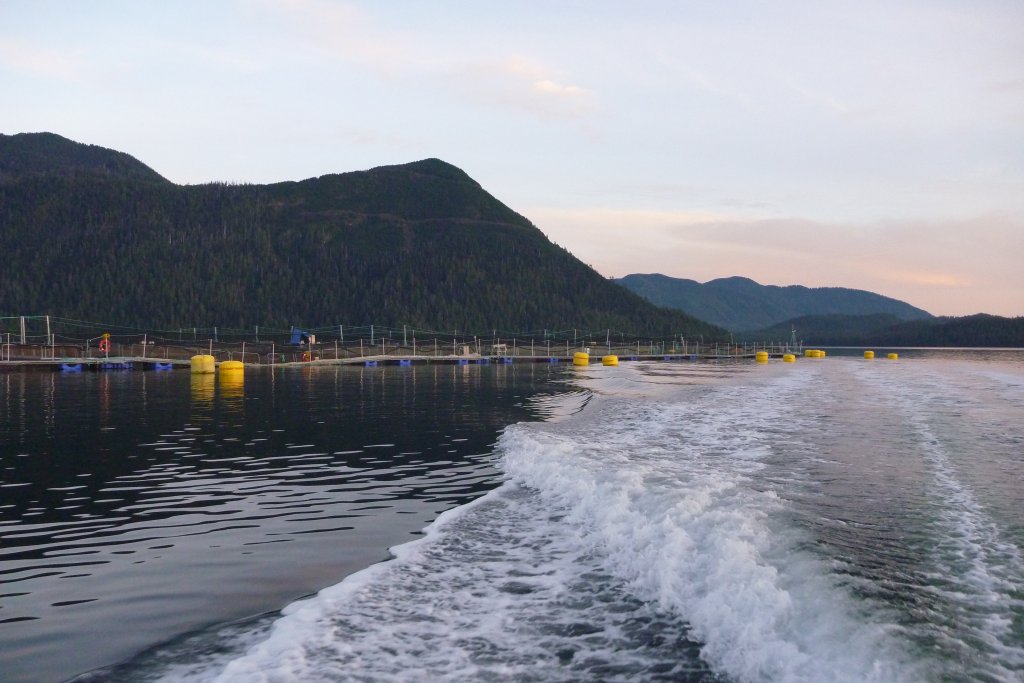
British Columbia’s inlets are often home to many aquaculture operators. The development of these inlet-specific models can help operators and regulators in a variety of ways, such as by helping them plan best management practices and for potential future changes. For example, Dr. Bianucci and her team have implemented particle tracking in her models, which can simulate the dispersal of pathogens or contaminants from aquaculture farms (DFO 2021). Her current work is also focused on hypoxia and deoxygenation since this is what many fjords along the British Columbia coastline are experiencing. A couple of her recent collaborative studies have found long-term deoxygenation and warming trends in four BC fjords (Jackson et al. 2021), and have explored the seasonal occurrence of near-surface hypoxia in another inlet based on recent measurements (Rosen et al. 2022). She aims to use her models to improve the understanding of the dynamics behind these observed low oxygen events as well as how these events and dynamics may change under future climate scenarios. Furthermore, by studying several inlets and fjords, Dr. Bianucci hopes to address the spatial diversity of coastal hypoxia in these geomorphologically complex regions. For example, it is not yet fully understood why a subset of the inlets along the West Coast of Vancouver Island experience hypoxia while some do not. Dr. Bianucci believes that differences in the bathymetry and sill locations, how the inlets are aligned with the main winds, and the type of freshwater forcing reaching the fjords are likely some of the key drivers in setting inlet biogeochemical properties. This work is still in progress, but Dr. Bianucci is very much looking forward to seeing the outcomes of her modelling work in this region.
Over the coming years, Dr. Bianucci hopes to expand her models to include even more coastal areas. These models can be used to see the impacts on and from any given aquaculture farm, and help to establish the best management practices. She also hopes to use these models to understand how extremes and climate change as a whole will impact the important near shore regions of British Columbia, in terms of hypoxia, acidification, and temperature. It will be incredibly important over the coming years to get a firm grasp on these stressors and how they will affect the local fish stocks and aquaculture farms; high-resolution ocean modelling is a formidable tool for the task.
This article was written by Dr. Krysten Rutherford based on an interview with and input from Dr. Laura Bianucci and images from Glenn Cooper.
Krysten Rutherford (she/her) is a postdoctoral fellow at the Institute of Ocean Science in Sidney, BC, and completed her PhD in 2021 at Dalhousie University. She implements and develops high-resolution models to better understand present-day processes and the potential future impacts of climate change on coastal systems.
Laura Bianucci (she/her) is a research scientist at the Institute of Ocean Science in Sidney, BC. Before joining Fisheries and Oceans Canada in 2017, she was a scientist at Pacific Northwest National Laboratory (Seattle, WA, USA) and a postdoc at Dalhousie University. She holds a PhD from the University of Victoria (2010).
References
DFO. 2021. Hydrodynamic Connectivity between Marine Finfish Aquaculture Facilities in British Columbia: in support of an Area Base Management Approach. DFO Can. Sci. Advis. Sec. Sci. Resp. 2021/042.
Jackson, J. M., Bianucci, L., Hannah, C. G., Carmack, E. C., & Barrette, J. (2021). Deep waters in British Columbia mainland fjords show rapid warming and deoxygenation from 1951 to 2020. Geophysical Research Letters, 48, e2020GL091094, https://doi.org/10.1029/2020GL091094.
Rosen S, Bianucci L, Jackson JM, Hare A, Greengrove C, Monks R, Bartlett M and Dick J (2022). Seasonal near-surface hypoxia in a temperate fjord in Clayoquot Sound, British Columbia. Front. Mar. Sci, 9:1000041, doi: 10.3389/fmars.2022.1000041.
Colombie-Britannique, krysten rutherford, laura bianucci, océans